
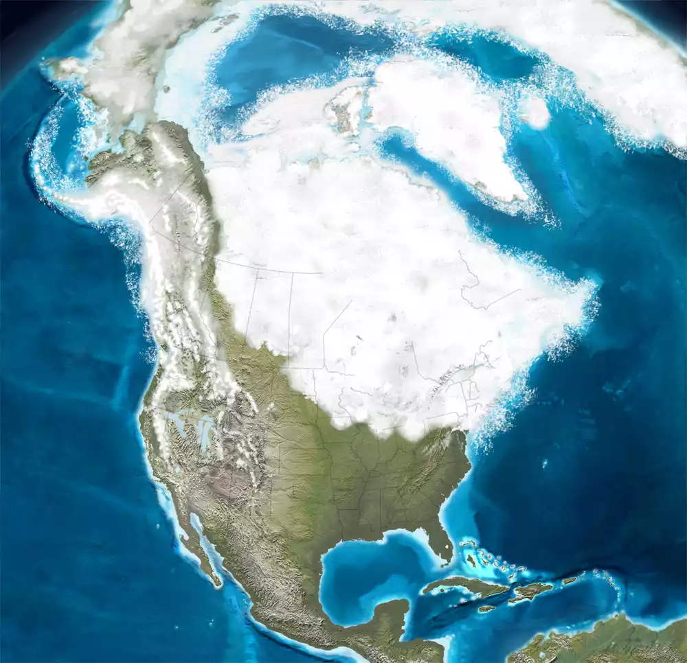
17,500 years ago
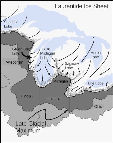
As the Huron-Erie Lobe, a broad, tongue-like extension of the Laurentide Ice Sheet that advanced outward from the main ice sheet, advanced and retreated multiple times across northwest Ohio and northeast Indiana, it created numerous moraines. A moraine is a long, crescent-shaped ridge or mound of rock, soil, and other debris that becomes embedded in or pushed along by an advancing glacier as it moves across the land.

As the glacier carries this material, it eventually deposits it when the ice slows down or melts, creating a moraine. These moraines mark places where the edge of the glacier paused for a time, allowing debris to pile up before the glacier continued its retreat. Many of the gently rolling hills in northwest Ohio and parts of northeast Indiana are the result of these glacial deposits.
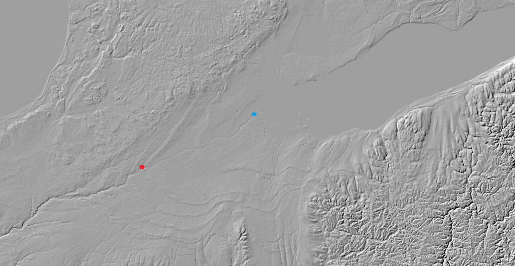
As the Huron-Erie Lobe retreated from northwest Ohio around 17,500 years ago, glacial meltwater became trapped between the ice front and the recently deposited Fort Wayne Moraine. The moraine acted as a natural dam, forming Glacial Lake Maumee. At its highest stage, the lake initially drained southward through a low outlet near present-day Fort Wayne, Indiana, into the Wabash River system and ultimately the Mississippi River.
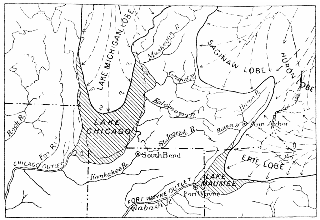
At its greatest extent, the lake may have held a volume of water comparable to or even greater than modern Lake Erie. As the glacier continued to retreat and meltwater continued to fill the basin, the lake gradually rose until, about 14,000 years ago, its surface reached approximately 800 feet (244 m) above sea level. The rising water eventually overtopped a low sag in the Fort Wayne Moraine, which triggered a major outburst event.
The Maumee Torrent
Once overflow began, erosion quickly enlarged the outlet cut into soft glacial sediments, triggering the catastrophic Maumee Torrent. Over a relatively short period of time, an immense volume of water rushed westward through the Fort Wayne Outlet and the Little River Valley into the Wabash River system, carving the broad Wabash-Erie Channel and dramatically lowering lake levels.
Although the flood released a large portion of the lake’s water, it did not completely drain Glacial Lake Maumee. Instead, the lake persisted in a series of lower stages, leaving behind well-developed beach ridges that record its gradual step-down as drainage patterns continued to shift with the retreat of the ice sheet.
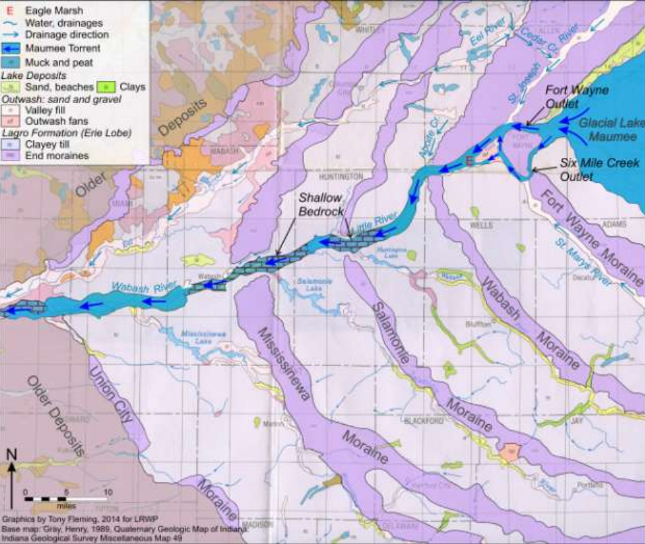
One important consequence of this event is that the Fort Wayne Outlet valley is far larger than the modern Little River that now occupies it. This “oversized” valley reflects its origin as a high-discharge channel carved during the Maumee Torrent and subsequent episodes of elevated flow from Glacial Lake Maumee, rather than by the much smaller stream that exists today. The scale of the valley provides clear geomorphic evidence that the outlet once carried vastly greater volumes of water before the drainage route was abandoned.
By the later part of this interval (roughly 15,000 to 14,000 years ago), humans were likely beginning to enter parts of the broader Great Lakes and Ohio Valley region as newly ice-free corridors opened along the retreating ice margin. However, direct archaeological evidence from northwest Ohio at this earliest stage remains limited.
14,000 years ago
When the retreating ice front had reached the site of Imlay City in eastern Lapeer County, southeastern Michigan (about 60 miles north-northwest of Detroit), a lower outlet than the Fort Wayne channel was uncovered, and the waters of Glacial Lake Maumee fell rapidly by approximately 10 to 20 feet. This development likely occurred around the late phase of Lake Maumee’s existence, roughly 14,000 years ago, as the Huron-Erie ice lobe continued to retreat northward. This new outlet, the Imlay channel, was from one-third to one mile wide and averaged about one-half mile in width. Its floor of sand and gravel suggests that the drainage lacked the erosive vigor of the earlier catastrophic outburst. The channel directed flow through the Flint and Durand area into the Grand River system, which discharged into Glacial Lake Chicago at the southern margin of the Lake Michigan ice lobe. From there, waters ultimately reached the Mississippi River via the Illinois River system. The Imlay outlet does not appear to have been large enough to capture the full discharge of the lake, and the Fort Wayne outlet likely remained active for a time as well.
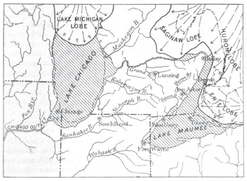
14,000 to 13,500 years ago
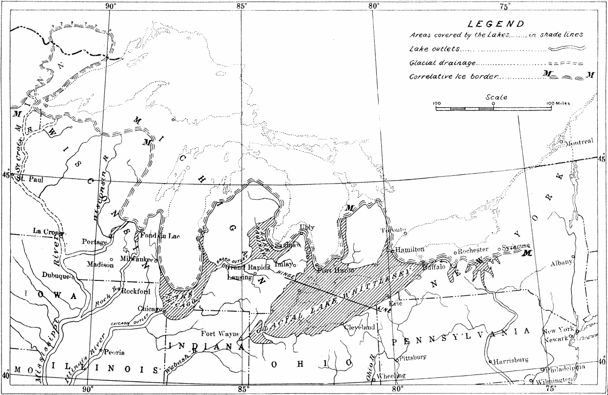
As the Laurentide Ice Sheet continued to retreat around 14,000 to 13,500 years ago, it exposed a lower drainage pathway known as the Ubly Outlet in the “Thumb” region of eastern Michigan (Huron County), which connected the Erie and Saginaw basins. Once this route became ice-free, water from the later stages of Glacial Lake Maumee shifted away from its earlier southwest outlet through the Fort Wayne area and the Wabash River system. Instead, it began draining northward into Glacial Lake Saginaw, marking a major reorganization of regional drainage. This change ended the Fort Wayne Outlet’s role as the primary drainage path for the Erie basin and reflected the continued lowering and northward migration of outlets as the ice sheet retreated.

This new drainage pattern helped establish a lower and more stable lake level in the Erie basin, leading to the formation of Glacial Lake Whittlesey. Lake Whittlesey covered much of the same geographic area as earlier Maumee-stage lakes but stood at a noticeably lower elevation, reflecting ongoing adjustment of outlet controls during ice retreat.
Indigenous peoples were present in parts of the broader Great Lakes region during this general period, living in landscapes shaped by shifting shorelines, expanding waterways, and the ongoing retreat of the glaciers.
13,500 to 13,000 years ago
After the Whittlesey stage, continued retreat of the Laurentide Ice Sheet further reorganized drainage within the Lake Erie basin. As the ice margin shifted and outlets were alternately opened, modified, or temporarily restricted by differential land rebound following deglaciation, lake levels fell from the Whittlesey highstand into a lower and more variable phase known as Glacial Lake Arkona (about 13,500 to 13,000 years ago). Rather than a single stable lake level, the Arkona stage was characterized by fluctuating water surfaces and the development of multiple shoreline features, reflecting frequent adjustments in outlet control and ice-front position.
13,000 to 12,500 years ago
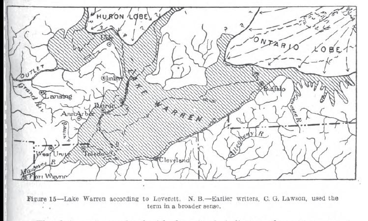
Continued ice retreat led to another reorganization of drainage pathways, giving rise to Glacial Lake Warren (about 13,000 to 12,500 years ago). Like the Arkona stage, Warren was not a single uniform lake level but a complex interval of shifting water elevations and shoreline positions. However, it represents a further lowering and continued instability of the basin as isostatic rebound and evolving outlet gradients repeatedly altered lake behavior. Compared with the relatively more stable Whittlesey highstand, both Arkona and Warren record a prolonged transitional phase in which the Lake Erie basin adjusted to rapidly changing glacial and post-glacial conditions.
12,500 to 12,200 years ago
As the Laurentide Ice Sheet continued to retreat from the Lake Erie basin, the region entered the Lake Wayne stage (about 12,500 to 12,200 years ago). During this interval, water levels were increasingly controlled by lower eastern outlets as northern and northeastern drainage routes became more dominant. This stage represents a further lowering and simplification of the basin, as the lake system became more directly integrated into the developing Great Lakes drainage network to the east.
12,200 to 12,000 years ago
Continued adjustments in ice position and outlet elevations then led to the Lake Lundy stage (about 12,200 to 12,000 years ago). This relatively brief but important phase reflects continued eastward drainage through progressively lower outlets, while earlier southwest-flowing routes had become inactive. Lake Lundy represents one of the final intervals of instability near the retreating ice margin, when even small changes in outlet elevation produced significant shifts in lake extent and water level.

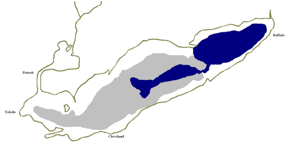
As the Huron–Erie ice lobe continued to retreat and regional drainage pathways stabilized, the large, ice-margin lakes that had characterized northwest Ohio gradually diminished. Water levels became increasingly stable as the Great Lakes system developed more integrated and persistent connections between basins, and the western Lake Erie basin evolved toward the early form of modern Lake Erie.
11,500 to 11,000 years ago
Around 11,500 to 11,000 years ago, after the edge of the ice sheets had retreated well north of the Lake Erie basin, water levels and outlet positions continued to adjust in response to ongoing isostatic rebound and the reorganization of regional drainage pathways.
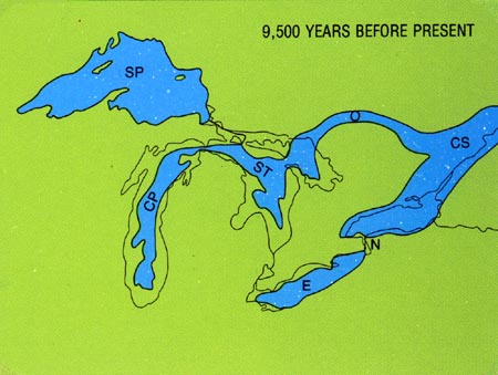
During this interval, the western basin moved away from rapidly shifting ice-margin lake stages, and drainage became increasingly organized into a more persistent eastward-flowing system, setting the stage for the establishment of the Niagara outlet.

11,000 to 10,500 years ago
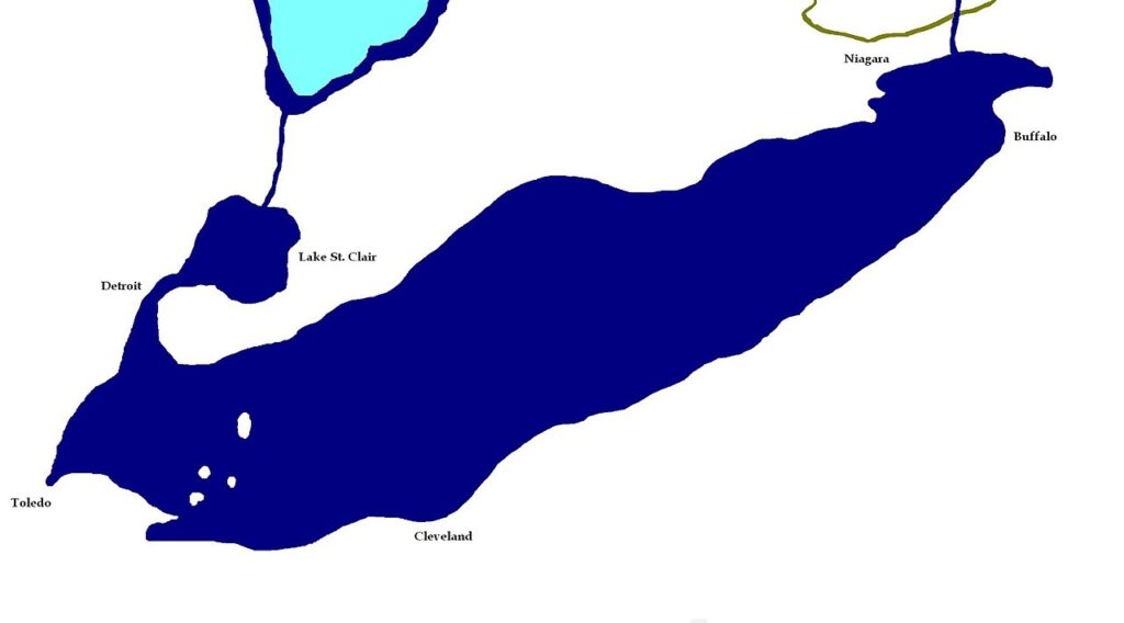
As the ice sheets continued to retreat beyond the eastern edge of the basin, drainage became fully integrated through the Niagara River system roughly 11,000 to 10,500 years ago. Flow over the Niagara Escarpment began to progressively deepen the channel, while ongoing isostatic rebound following the removal of the ice load continued to adjust regional gradients. Together, these processes reduced the large and frequent lake-level fluctuations that had characterized earlier glacial stages.
10,000 years ago
By about 10,000 years ago, Lake Erie had largely assumed its modern form, with a stable eastward outlet through the Niagara River into Lake Ontario and, ultimately, the St. Lawrence River system.
Postglacial Exposure and Development of the Maumee River
As the outlet of Lake Erie stabilized near the Niagara region and the lake approached its modern form, the former lakebed in northwestern Ohio was fully exposed as water levels fell. This surface, shaped by Glacial Lake Maumee and its later stages, was left as an extremely flat plain with very limited natural drainage.

In the absence of well-defined river channels, water initially spread across the landscape as widespread wetlands, shallow ponds, and persistently saturated ground. As conditions stabilized, flow began to concentrate into developing stream networks, marking the beginning of the Maumee River system and the broader drainage network of the region.

10,000 to 8,000 years ago
During the early Holocene (about 10,000 to 8,000 years ago), the Maumee River took shape as the main trunk stream flowing toward what is now Toledo. As it extended upstream, it integrated smaller streams and incorporated existing drainage systems, including the ancestral St. Joseph and St. Marys Rivers, reorganizing much of the former Lake Maumee basin into a unified eastward-draining river system.

9,000 and 6,000 years ago
Between about 9,000 and 6,000 years ago, continued stream integration and extremely low regional relief produced a landscape dominated by sluggish flow, widespread wetlands, and shallow depressions where water frequently accumulated.
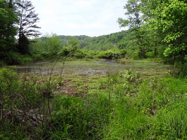
Persistent saturation slowed decomposition of organic material, allowing thick deposits of peat and muck to form and further expand wetland conditions across the former lake plain.
Development of the Great Black Swamp and Stabilization of the Landscape

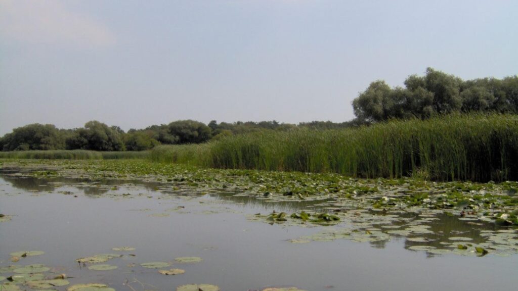
Over thousands of years, the nearly flat topography of northwestern Ohio, combined with fine sediments left behind by Glacial Lake Maumee and persistently poor drainage, gave rise to the vast wetland complex known as the Great Black Swamp.

The swamp reached its maximum extent during the middle to late Holocene. Throughout this time, the Maumee River served as the principal outlet for the former glacial lake basin, transporting sediment eastward into Lake Erie and linking an extensive network of streams, wetlands, and low-lying floodplains.
7,000 to 6,000 years ago
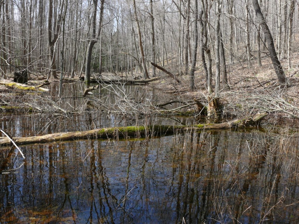
By about 7,000 to 6,000 years ago, the Maumee Valley had largely stabilized into its modern configuration. Major river channels and drainage patterns were established, and subsequent changes occurred gradually. Rivers continued to migrate slowly across their floodplains, soils continued to develop, and ecological communities evolved over time. Low-lying areas left behind by the glacial lakes progressively filled with sediment, further refining the basin’s broad, low-relief landscape.
3,000 years ago
Beginning around 3,000 years ago, Indigenous peoples increasingly influenced the landscape through land use practices, settlement patterns, and resource management. These activities affected vegetation structure, shaped travel corridors, and influenced the distribution of resources along rivers and wetlands. These human influences operated alongside natural processes and continued into more recent periods, with the Maumee River functioning as an important transportation route and ecological corridor within the broader Great Lakes and Eastern Woodlands region.
500 to 200 years ago: European settlement and transformation
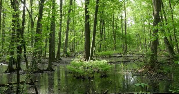
Beginning roughly 500 to 200 years ago, European contact and settlement introduced rapid and large-scale landscape change. Forests were cleared, wetlands were drained, and agricultural land expanded across the former swamp.

These alterations changed surface water flow, reduced wetland extent, and increased sediment delivery to streams and rivers.

As a result, rivers became more responsive to rainfall events, with faster rises in water levels and increased flood peaks.
The past 200 years
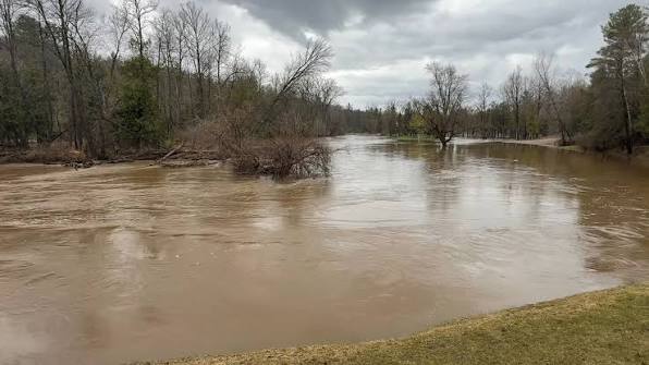
Over the past two centuries, Euro-American development transformed the Maumee River basin even further. Much of the Great Black Swamp was drained and converted into farmland through an extensive system of ditches and subsurface drainage tiles.

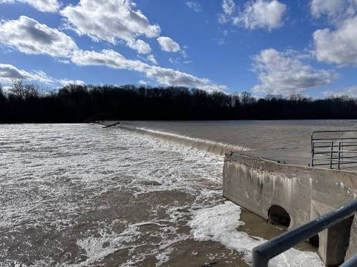
Dams, levees, and channel (human) modifications further constrained the river’s natural floodplain dynamics.
Today

Today, the Maumee River remains the primary drainage system of the western Lake Erie basin. While it continues to follow the course established after the last Ice Age, it now flows through a landscape profoundly shaped by centuries of human activity, linking a heavily modified watershed to Lake Erie.
Legacy of a Changing Landscape
The story of Proglacial Toledo is ultimately the story of a landscape in transition. Over thousands of years, retreating glaciers, immense proglacial lakes, shifting drainage routes, and steady erosion transformed a barren ice-margin into the river valley seen today. The modern Maumee is the final expression of those postglacial changes, occupying a course established by processes that began nearly 17,500 years ago.
Although agriculture, cities, engineering, and industry have dramatically altered the watershed in recent centuries, the river itself remains a living reminder of the forces that reshaped the Great Lakes region at the end of the last Ice Age. Every floodplain, terrace, and bend preserves part of that much longer geological history, connecting present-day Toledo to the ancient landscape from which it emerged.
